



Politecnico di Milano · ABC Department
3D Survey Group
Geomatics, 3D Documentation and Spatial Information Management
Research in surveying, three-dimensional reconstruction and spatial information technologies for architecture, cultural heritage and complex environments.
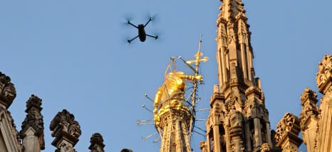
Milan Cathedral · UAV documentation, 2025
About the Group
The 3D Survey Group is a research unit of the Department of Architecture, Built Environment and Construction Engineering (ABC) at Politecnico di Milano. We develop and apply geomatics methods across different scales, from individual artefacts and buildings to archaeological sites, historic landscapes and territorial systems.
Our work connects field measurement, digital reconstruction, geometric analysis and information management. Research is carried out through scientific projects, surveys, collaborations and advanced training.
Methods and Technologies
From field acquisition to the interpretation and management of spatial information.

Topographic and GNSS Surveying
Control networks, georeferencing, precision measurement and monitoring to establish reliable spatial references.

Photogrammetry and UAV
Terrestrial and aerial image-based acquisition, 3D reconstruction, orthophotos and metric documentation.

Laser Scanning and Mobile Mapping
Terrestrial laser scanning (TLS), mobile mapping (MMS/MLS) and LiDAR acquisition for complex environments.

Point Clouds and AI-assisted Analysis
Multi-sensor registration, filtering, classification, segmentation and extraction of geometric information.

BIM, HBIM and 3D GIS
Information-rich modelling, spatial analysis and linked documentation for heritage and built environments.

Digital Platforms and Visualisation
Web-based 3D environments, collaborative data access, semantic information and immersive applications.
Selected Research and Applications
Research methods applied to real monuments, landscapes and acquisition systems.

Milan Cathedral
Integrated 3D surveying, digital modelling and information systems support the documentation, interpretation and conservation of a complex architectural monument.

MAPFOR
Multi-source spatial data for mapping peri-urban forest structures, climate-related risks and resilience.

ATOM-ANT3D
Portable multi-camera acquisition and 3D reconstruction in confined and geometrically complex environments.
Latest Updates
Selected research news and public engagement from the Group.
Public engagement
International Day for Monuments and Sites
A video contribution presenting the Group’s work in heritage documentation.
Research news · Meeting held 25 March
MAPFOR Project Kick-off Meeting
Launch of the Italy–Switzerland research initiative on peri-urban forest monitoring.
Fieldwork
3D Survey of the Mirafiori Weir
Survey and documentation of hydraulic infrastructure on the Trebbia River.