


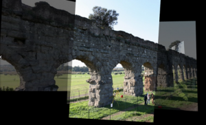
In November 2009 is been leaded one first survey test on a six arches portion (from pillar 49 to 55) of Claudio’s Aqueduct that is located in the aqueduct park in the south of Rome. The aim of the test was to find the best measurement and representation methods according to the goals of Roma Archaeology program.


There were leaded several survey operation:
- laser scanner acquisition;
- photogrammetrical acquisition using the profession camera Canon 5D Mark II with high definition and a 35mm fixed focal length, settled on a calibration polygon in lab
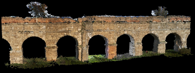
Three-dimensional Model completed with the surveyed part of the aqueduct, south-west front and particoular
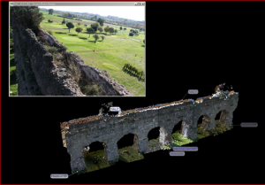
In the three-dimensional model is possible to save annotations and links to external files. In this case is shown a link that leads to a series of images taken from above that describe the health situation of the top of the aqueduct.
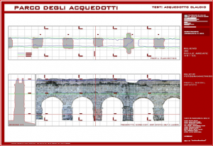
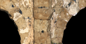
Representation of one horizontal and vertical section of the part considered by the test
Cfr.: Monti, C., Gasparoli, P., Fregonese, L., Achille, C., Bassi, S., Fassi, F., Scaltritti, M., Gli acquedotti. Prime attività ricognitive per un approccio di “sistema”. Rilievo e visite ispettive, In Roma archeologica. Interventi per la tutela e la fruizione del patrimonio archeologico. Secondo rapporto, a cura di Roberto Cecchi, pag. 222-242. Ed. Electa 2010